I’ve given a great deal of though to my final Omeka Exhibit in regards to my topic of the Smithsonian National Zoo, and I’ve really gained a grasp of how it needs to be planned out and designed to achieve maximum clarity and potency. My exhibit will explore the topic of the Smithsonian National Zoo in all aspects, from it’s development and construction, to it’s scientific impact , and on to how it has affected the public. I want to explore the facts behind the Zoo, as well as how it has contributed entertainment to the public, and served to educate them. I’m also interested in scientific advances and the Zoo’s role in learning and teaching about different species, as well as how it has been used in politics and science.
As far as my exhibit, I intend to have around five sections. The first would be documents, where I will present legislation and legal standings which allowed for the construction of the Zoo and established how it should be run. The second section is “images” which holds images of animals within the zoo and the physical structure of the zoo, ranging from the time of it’s opening to modern day.
The third section I have created is “Political Affairs”, where I will compile documents and information in regards to both advances in international and local wildlife conservation and affairs, as well as the zoo’s role in diplomacy with other nations, primarily the Pandas and our relations with the People’s Republic of China.
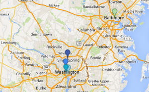
The fourth section I have created is called “Data”, and will include graphs and visual data which will give intel into the zoo’s popularity and importance based on numerical data and statistics. I am still in the process of creating the graphics for such graphs, and will post them when they are ready. In this section, I will also include the map I created to show the location of the Zoo to other important locations in DC.
The last section I create will primarily focus on secondary sources and the controversy surrounding the zoo and its practices. As always, all sides of the argument must be analyzed, and the downfalls and criticisms of the zoo are just as important as all of the wonderful contributions it has made to the public and scientific world.
Together, these sources will all aid in telling a complex and ever changing story about an important establishment in our Nation’s capital. The images, data, documents, and articles I compile will provide a feel of how the zoo has changed since it was first established, and how the public, and our country, have changed along with it. They will provide a visual and statistical understanding of the zoo’s importance within our society, as well as how it has both aided us politically, socially, and scientifically, and the controversy it has created.

