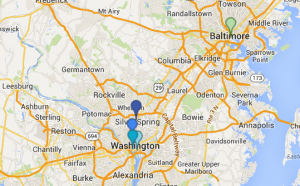
One vital step in understanding history is understanding maps. Maps, new and old, electronic or hand-drawn, all helps to serve as a visual aid for understanding historical landmarks and events, and how they may interrelate to each other. I create the above map using google’s “maps enginge”, in order to display important locations in the understanding of the Smithsonian National Zoo, and it’s role within the society of Washington, D.C. I, of course, marked the Zoo itself, as well as Association of Zoos and Aquarium’s Headquarters, the Smithsonian Institution Building, and the National Academy of Sciences on the first layer, as they all play an integral role in running, maintaining, and aiding the zoo in it’s public operations and the care of its animals. On the second layer, I marked the National Aquarium, as it falls under the same category as the zoo in terms of it’s role as a scientific landmark and a public exhibit for education and entertainment.
I didn’t have much difficulty while actually making the map, other than locating some of the latitude and longitude points and verifying that I had them correct. The maps engine was simplistic enough to use with ease, but still allowed for customization and personal preferences to be utilized. The map itself is useful in understanding how all of these organizations and buildings work together to make locations like the Zoo and the Aquarium run and benefit our city educationally and socially. Seeing the areas in relation to each other really gives an idea of their importance, due to their central location within the city and their proximity to each other.
Creating a map is an extremely helpful and important part of understanding historical situations, and is definitely something I’ll be utilizing in my future research.

